Surface emission surveys are used to measure the rate that ground gases are emitted into the atmosphere, which can be quantified in order to determine the risk to the environment or other receptors, such as a property and human health. The concentration and flow of ground gas can alter depending on the location of a monitoring point, source material, geology, atmospheric conditions and groundwater levels. Therefore, an emissions survey can be a useful line of evidence to better conceptualise the actual concentration/volumes of ground gas that may be impacting a given receptor.
Surface emission surveys are commonly used on landfill sites following the placement of a temporary or permanent capping layer, in order to confirm compliance with the environmental permit or conditions. Guidance on this subject can be found in the Environment Agency’s document LFTGN07 V2 (2010). A useful precursor to a survey, and requirement of landfill surrender is to visually assess any evidence of vegetation stress or dieback that could be caused by ground gas, as well as note the condition of the surface layer i.e. note any defects in the capping layer that may allow a route for ground gas to escape.
A surface emissions survey typically comprises two elements:
- A walkover survey taking gas readings just above the ground surface, and landfill infrastructure (which is often referred to as the surface emissions survey)
- flux chamber tests at selected locations based in (i) or on a grid.
The walkover survey uses a handheld instrument, such as a flame ionisation detector (FID) or tuneable laser diode, which detects organic compounds such as methane at very low concentrations (0.1 parts per million). This again can be used to assess any defects in the capping layer and leaks from landfill infrastructure. The EA guidance states that if a FID survey records concentrations of over 100ppm over the capping layer, or 1000ppm next to a discrete feature such as a monitoring well, then remedial action should be undertaken. The survey results should be geo located and typically contour plots of the data are produced.
The flux chamber survey is used to quantify the volumes of methane emitted from a landfill to confirm that any active gas venting systems are working correctly and to minimise the amount of methane emitted into the atmosphere, a requirement of the Landfill Directive (1999). In the UK it is most common to use a static flux chamber. Essentially a flux box is a vessel of a known area/volume where the concentrations of gas can be monitored (using a FID or other monitoring device with an equally low detection limit) over a period of time in order to calculate the emissions based on the flux in concentrations (see Pictures 1/2). However, it is important to note that the flux box, like any other gas monitoring method, has its limitations. It can be difficult to create a good seal between the flux box and underlying ground, therefore a level surface with the vegetation removed is necessary. Also, a flux box can provide skewed readings if placed over preferential points such as cracks or on the edge of a capping layer where gas can escape, so the survey requires careful design involving multiple points spread across an area, based on the initial surface emissions survey.
With respect to contaminated land investigations where the principal objective is to assess the risk to an existing or future development, a surface emission survey is a valued line of evidence to confirm calculated rates using measured borehole data, along with empirical data. In relation to calculated rates, the ‘Peckson method’ is often cited, which assumes that borehole’s zone of influence is 10m2. However, this method does not consider differences in the permeability of the underlying geology (leading to over conservatism) and potential preferential pathways such as services. A more detailed assessment to calculate the movement of ground gas via diffusion or advection can be undertaken using Ficks or Darcey’s Law.
A flux box survey can also be useful technique where there is a shallow source of gas / where shallow groundwater levels limit the use of monitoring wells (flooding the response zone, which prevents the ingress of gas), assuming the conceptual site model indicates a viable risk. Other lines of evidence, including visual description of the source material and soil testing for organic matter, should always be used alongside the emissions test to provide robust risk assessment. The flux box test is not well suited to assess risk from deep sources, or if new pathways for ground gas migration are introduced by the development from foundations or services.
With regards to monitoring, the placement of shallow monitoring wells (<5m) over a deeper source can aid characterisation of the risk if there are intervening cohesive layers that limit the vertical migration of the gas, or in establishing flow dynamics in historical landfills by contrasting the results with deeper wells. Careful consideration should be given to the existing and possible future pathways of gas migration when designing the monitoring positions ideally placing them at some significant point between the source and receptor. The use of continuous monitoring devices that record gas concentrations and flow (depending on the device) along with atmospheric conditions (typically every 1 hour) have become a well-established method of monitoring ground gas. They are extremely useful for rapidly assessing any trends in concentrations and the ‘worst-case conditions’, the results of which can be used when calculating the emission rate.
In summary, emission surveys are commonly used on active landfill sites to ensure compliance with the environmental permit. These techniques can also be used as a line of evidence when assessing the risk to a development from ground gas. However, these surveys do have limitations and should not be used in isolation. Anyone using the approach should ensure that the design of the survey is relevant to the CSM for the site. Further technical guidance would therefore be beneficial to the contaminated land industry to ensure consistency of approach in different ground model and risk assessment situations.
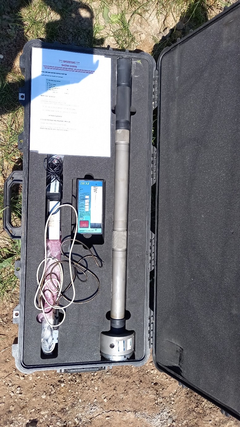
Picture 1 Continous monitoring device
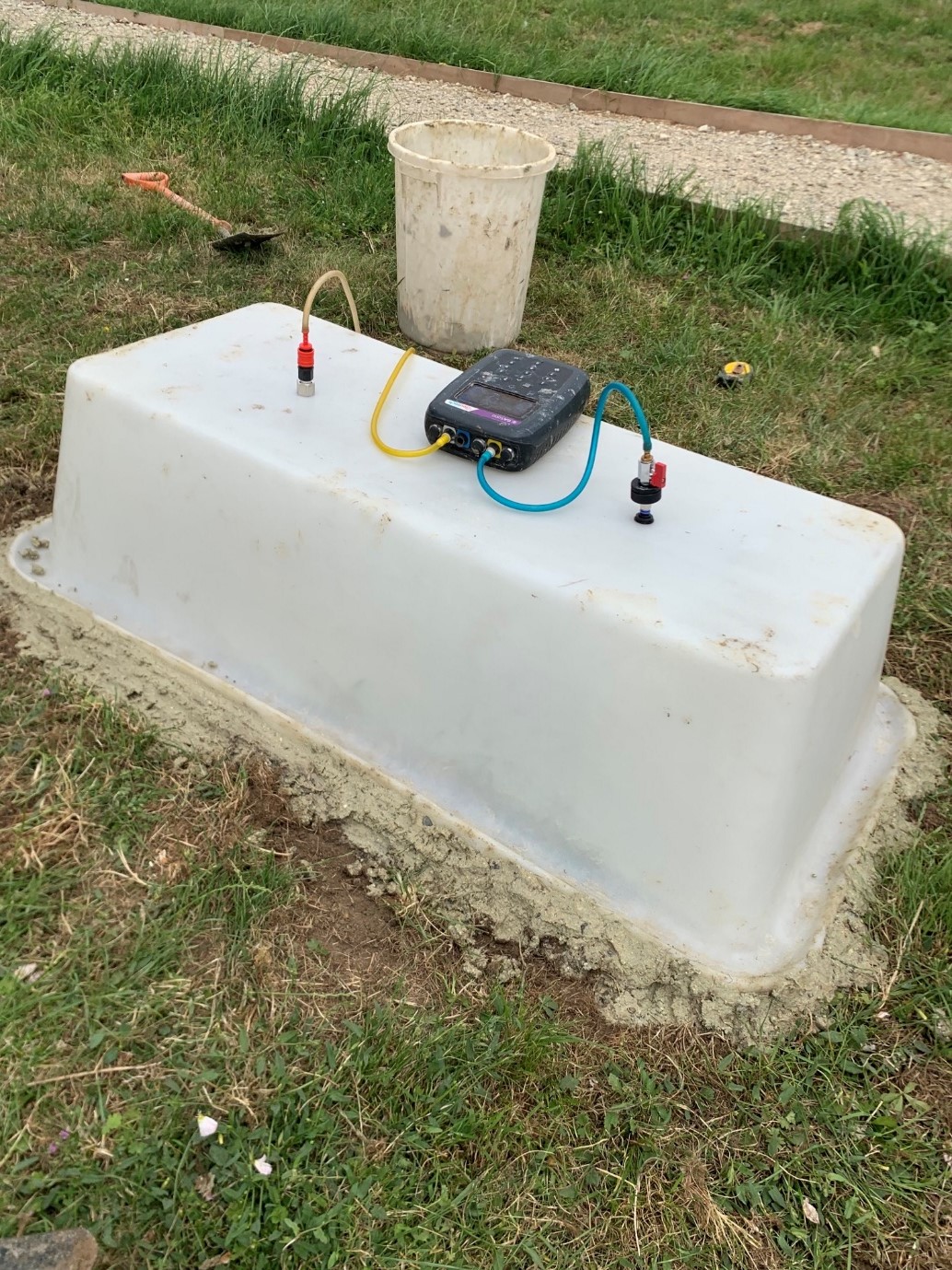
Picture 2 Example of Flux Box
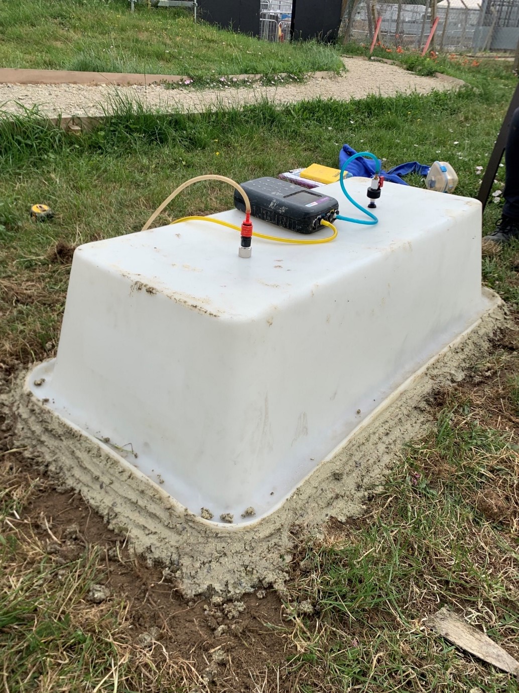
Picture 3 Example of Flux Box
References
- The Ground Gas Handbook, Steve Wilson, Geoff Card and Sarah Hains, 2009.
- LFTG07: Guidance on measuring landfill surface emissions, Environment Agency, 2010.
- BS8576 Guidance on investigations for ground gas – Permanent Gases and Volatile Organic Compounds, British Standard Institute, 2013.
- Ground gas – an essential guide for house builders, NHBC, 2023
All images provided by RSK.
Article provided by Andrew Tranter, Principal Environmental Consultant at RSK