AGSi is a transfer format for ground model and interpreted data, created and maintained by the Association of Geotechnical and Geoenvironmental Specialists (AGS). It was launched, as a beta version, in November 2020 with a further update issued in November 2021. Documentation for AGSi can be found here.
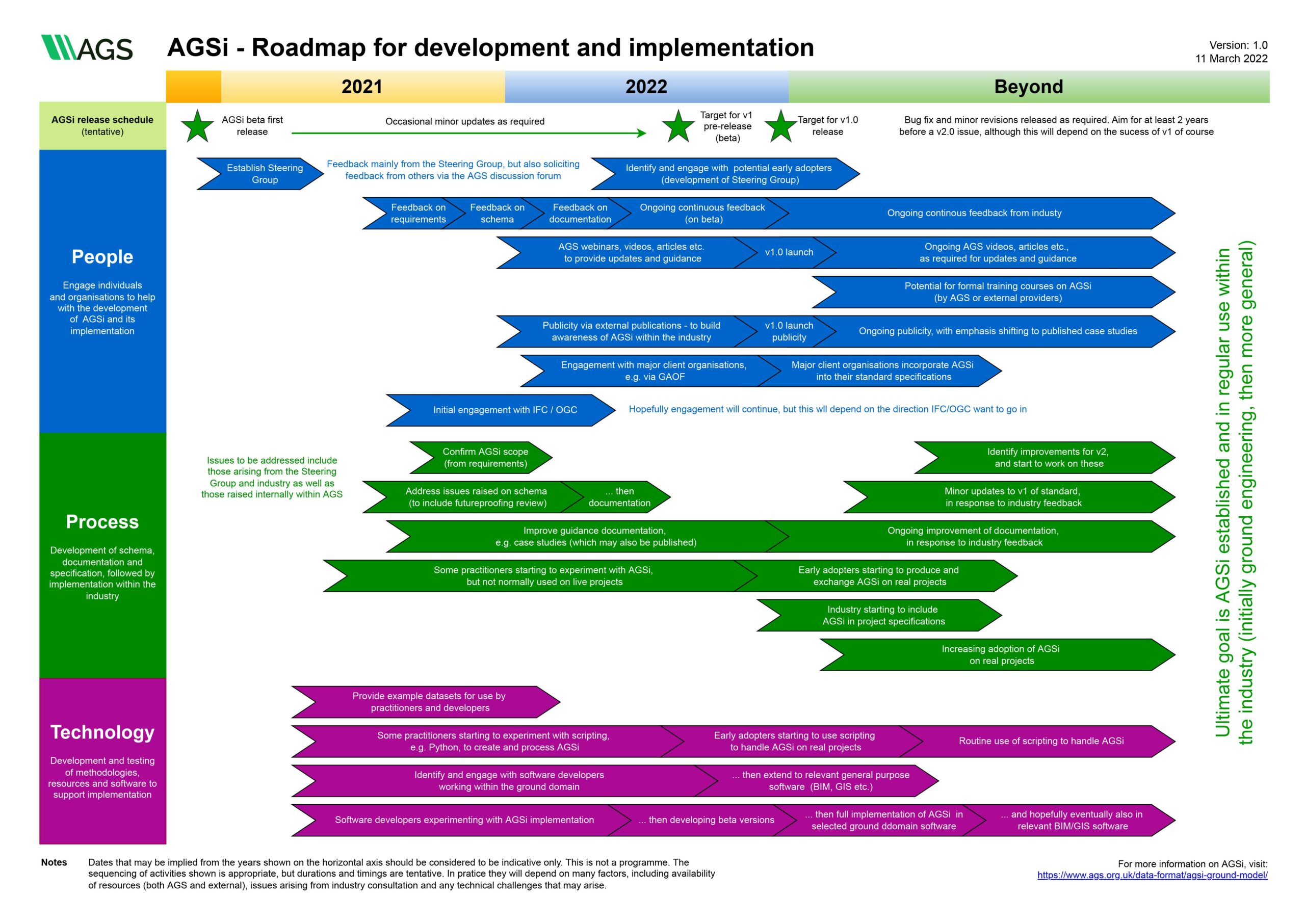
AGS have now issued a roadmap for the future of AGSi. This identifies the processes and actions required to get AGSi ready for its first formal release (version 1.0), before going on to look at what needs to happen to achieve the ultimate goal of establishing the use of AGSi in our industry, for the benefit of the industry.
The roadmap identifies a steering group that has already been formed and the plan is for an early adopter user group to develop out of this. If you are interested in joining the steering group or getting involved as an early adopter, then please get in touch with us.
AGS is aware of other international initiatives relating to geotechnical data and models. In particular, AGS is an active participant in the OGC Geotech Interoperability Experiment project that was launched in early 2022.
The current intent, reflected on the roadmap, is for AGSi version 1.0 to be formally launched at the The Geotechnical Data Conference, hosted by AGS and to be held on 1 December 2022 at The Burlington Hotel in Birmingham. Hope to see you there!