Article provided by Steve Thorpe, Geospatial Data Specialist, British Geological Survey
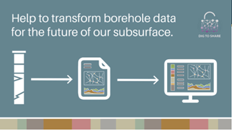
The “Big Borehole Dig” is a citizen science initiative by British Geological Survey (BGS) to enhance the number of digitised borehole logs we host and make available to everyone. BGS are enabling this call for help by asking all parts of the sub-surface community to join in and digitise borehole scans in the AGS data format using Groundhog geological software or Bentley Holebase/OpenGround.
Unforeseen ground conditions are quoted as being responsible for up to 50% of construction project overruns [1], and BGS aims to minimise this by making early-stage geological information readily available.
This article describes the Big Borehole Dig and all the information you need to join in.
The AGS data format
The use of AGS data format within the geotechnical and geoenvironmental community is growing stronger every day. I’ll assume that everyone reading this article already understands what AGS data is, so I won’t go into the details or its history.
How we use AGS data
BGS has always ingested borehole and ground investigation data. Since the beginning of the organisation in 1835 we have been a repository for geological and subsurface information. We have a store of over 1.4 million digital borehole records, and over 4 km of shelves full of physical samples and paper records. These days of course technology has given us space saving alternatives, so that now the capacity focuses on our servers and digital storage. The AGS data format is a big part of this digital transformation, it allows fast communication of geological data and information between different users and software. In 2014, we began the process of automatically ingesting AGS data – where users submit digital records. We built a database to handle the AGS data, allowing the files to be automatically validated, stored, and served exactly as they were deposited with us. It’s important to note here that no interpretation of the data is done by BGS, it is assumed that the user of the AGS format will check that the files are fit-for-purpose.
The automatic ingestion of AGS data aligns well with the BGS’ open data initiatives and means that the BGS remains a world-leading national repository of geological and subsurface information – a fact that we are very proud of. Anyone starting a new project can access the GeoIndex and find all the information they need, such as boreholes and geological maps, and can start their desk study safe in the knowledge that they have up-to-date BGS digital open data resources.
The Big Borehole Dig
The Big Borehole Dig is a citizen science project aiming to convert the open borehole scans held by BGS into more useable AGS data which will then be available for everyone.
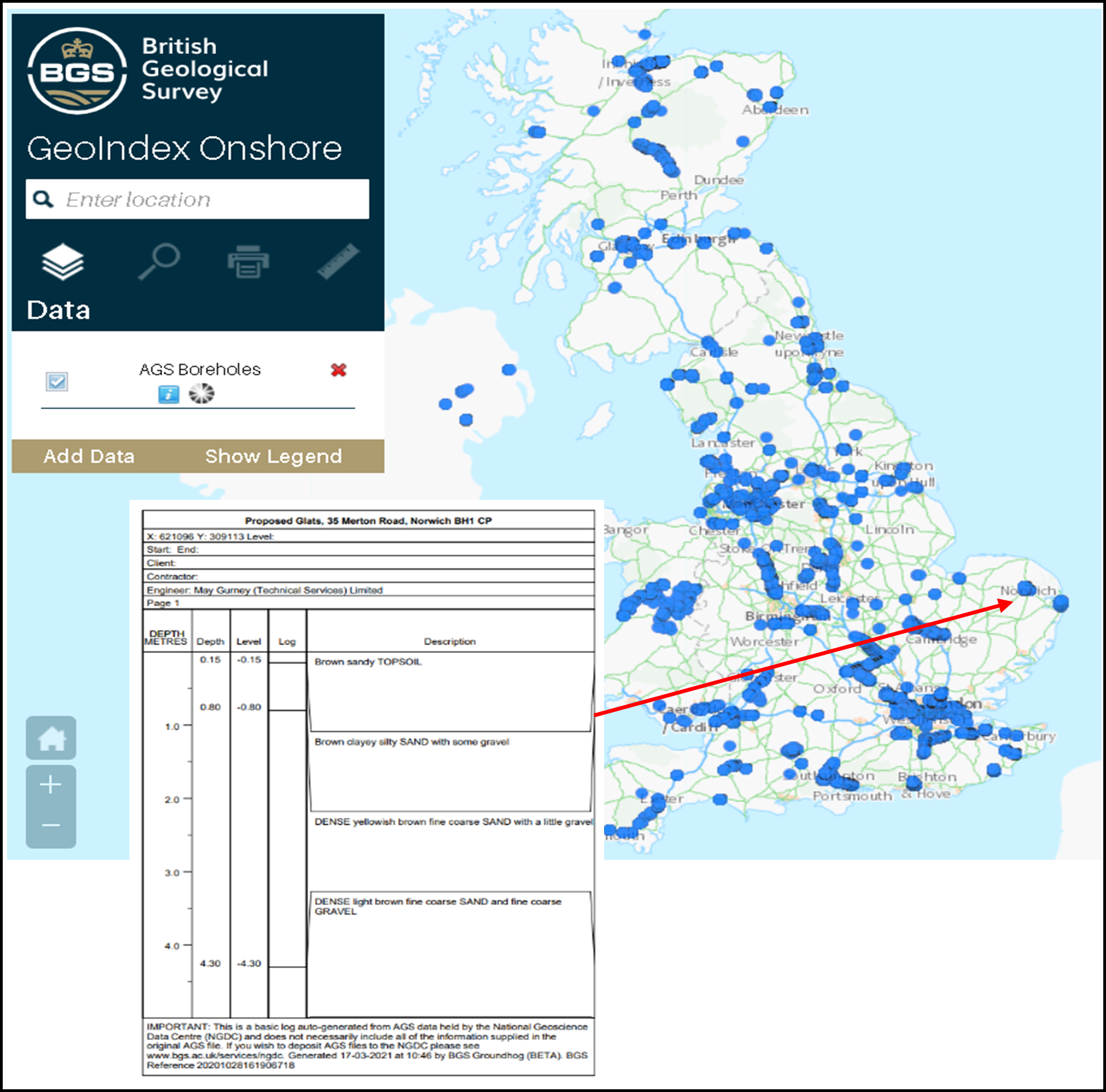
Of the 1.4 million borehole records the BGS hosts, each contains a variety of supporting information called metadata[2]. Attached to the majority of these borehole records is a digital scan of the original drillers log.
These open borehole records can be accessed through the BGS GeoIndex viewer (shown here). Despite being held in digital format (usually PDF), the information within these documents is not standardised and often requires translating and transcribing into borehole software or a database before being able to be used for geotechnical design or creating a ground model.
We believe it is essential that future generations have access to historical borehole data so we came up with a citizen-science project in which volunteers convert our open borehole records into AGS format in order to improve the availability and accessibility of borehole information to a wider audience. This will enable users to build better ground models, save costs on construction projects and reduce the amount of time lost due to unforeseen ground conditions.
We estimate that over 600,000 downhole geology logs exist as PDFs and these will be available as AGS format for everyone to use as the BBD project progresses. These data can feed directly into site investigations, conceptual ground models and academic projects, providing a much greater understanding of the sub-surface just when its needed at the start of projects. The Big Borehole Dig gives people around the world the tools they need to digitise our PDF scans, create an AGS file and send it back to BGS for storage, so that everyone can benefit from it.
You can take part in the Big Borehole Dig by downloading our free Groundhog Desktop software, or alternatively if you have access to OpenGround (or Holebase SI). We have produced a user guide for both software so please download the relevant user guide from the BGS Big Borehole Dig webpage.
In addition to the Big Borehole Dig, BGS is co-leading on the Dig-To-Share initiative with partners Atkins and Morgan Sindall. We are actively encouraging the sharing of data across the construction and civil engineering industry and using AGS boreholes to share the data is central to that philosophy. The Dig-To-Share first-year target was to digitise and release 10,000 boreholes in the AGS data format and we succeeded by releasing over 14,000! The more people that use and share AGS boreholes, the better we as a community understand the challenges of the subsurface and fill in the knowledge gaps. This will drive further innovation and data use, ultimately resulting in better ground models and more certainty in the construction processes. The Dig-To-Share team have created a Super User Network to encourage sharing within various organisations and are actively looking for new recruits.
Concluding remarks
The Big Borehole Dig aims to use volunteers to convert the openly available borehole scans held on the BGS website into AGS data.
The technical advances made by the AGS committee in developing and maintaining the AGS data transfer format allows fast communication and retrieval of borehole data and has been absolutely pivotal in the development of the BGS database, as well as the industry as a whole. It has provided the impetus for change in many organisations, including the BGS and with initiatives like the Big Borehole Dig we are opening people’s eyes to the possibility of sharing data, communicating in a standard way, and producing better ground models. Ultimately, this means that these boreholes will be available for everyone to use in their own projects, and will provide a valuable resource for future engineers and geoscientists.
The novel use of the AGS data format to digitise the thousands of legacy boreholes held by BGS will hopefully be a marker that people look back on as a turning-point in ground modelling. Imagine being able to import an initial 3D geological model made up of a plethora of BGS hosted AGS borehole records in to your virtual report, designing where to investigate based on known unknowns.
Come and join the Big Borehole Dig and play your part in digitising borehole data for the future!
References
[1] Foundations: Proceedings of the Second BGA International Conference on Foundations, ICOF2008. Brown M. J., Bransby M. F., Brennan A. J. and Knappett J. A. (Editors). IHS BRE Press, 2008. EP93, ISBN 978-1-84806-044-9. www.ihsbrepress.com
[2] Information held in the BGS database include: X,Y location, ground level, drilling company, purpose, and date drilled. Not all boreholes have this information attached but we try to record where it’s available